The WC or West Central London postcode area includes 15 postcode districts and 46 postcode sectors.
It includes some areas of the City of Westminster, the City of London, the London Borough of Camden, and the London Borough of Islington.
In total, it has 7,424 total postcodes and 2,610 live postcodes.
Check out some other postcodes in London.
- North West London Postcodes And Map
- East Central London Postal Codes And Map
- East London Postal Codes And Map
- South London Post Codes (Including South West And South East) And Map
- North London Postcodes And Map
- West London Post Codes and Map
- Full London Postal Codes
| Postcode Area | Postcode District | District and Area (whole or partial coverage) |
| WC | WC1A | New Oxford Street |
| WC1B | Bloomsbury Square Garden, British Museum, Russell Square | |
| WC1E | SOAS University of London, University of London, University College London | |
| WC1H | St Pancras, Russell Square, Gordon Square | |
| WC1N | Russell Square, Great Ormond Street | |
| WC1R | Red Lion Square Gardens, Gray’s Inn Square and South Square Gardens | |
| WC1V | Chancery Lane, Holborn, High Holborn | |
| WC1X | Pentonville, Kings Cross, Finsbury, Clerkenwell | |
| WC2A | Lincoln’s Inn Fields, Sir John Soane’s Museum, Royal Courts of Justice, Chancery Lane | |
| WC2B | Holborn, Lincoln’s Inn Fields | |
| WC2E | Covent Garden, Royal Opera House | |
| WC2H | Covent Garden, Leicester Square, The National Gallery | |
| WC2N | Charing Cross, Embankment | |
| WC2R | Charing Cross, Somerset House, Temple, Two Temple Place |
West Central London Postal Codes Map
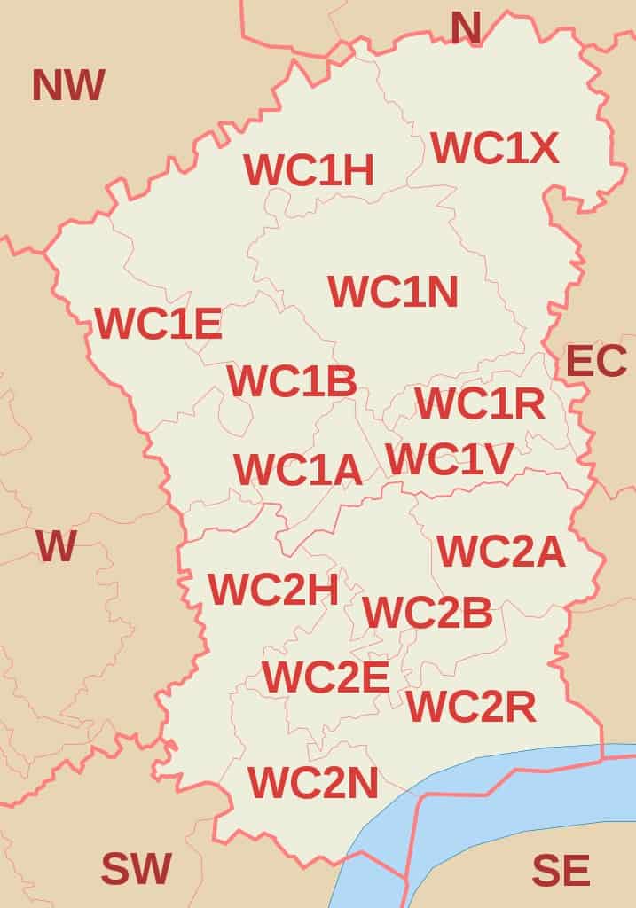
(WC Postcode Area Map by Richardguk via Wikimedia Commons)
Further Reading for UK postcodes.
- To learn more about Zip Code In The Uk, Check out our detailed guide to Uk Postcode.
- Check out our guide to London Postcode which you can learn how the London postcode works.
- Want to learn how to write a postcode in the UK? Here is our guide to the UK postcode format.
- Download the UK Postcode Map in case you want to check the postcode in the UK offline.
- Here is a list of Area Postcodes UK if you want to check the area postcodes quickly.