The London Underground has 11 lines: Bakerloo line, Central line, Circle line, District line, Hammersmith & City line, Jubilee line, Metropolitan line, Northern line, Piccadilly line, Victoria line, and Waterloo & City line.
It is easy to find them on the map with the help of the colored lines assigned by the Transport of London (TfL).
Contents
List of London Underground Lines
| Line | Start ↔ End Stations | Total Stations | Line Map Color |
| Bakerloo line | Harrow & Wealdstone ↔ Elephant & Castle | 25 | Brown |
| Central line |
|
49 | Red |
| Circle line | Hammersmith (H&C Line) ↔ Edgware Road (Circle Line) | 36 | Yellow |
| District line |
|
60 | Green |
| Hammersmith & City line | Hammersmith (H&C Line) ↔ Barking | 29 | Pink |
| Jubilee line | Stanmore ↔ Stratford | 27 | Gray |
| Metropolitan line |
|
34 | Magenta |
| Northern line |
|
52 | Black |
| Piccadilly line |
|
53 | Dark blue |
| Victoria line | Brixton ↔ Walthamstow Central | 16 | Light blue |
| Waterloo & City line | Waterloo ↔ Bank | 2 | Turquoise |
Bakerloo line
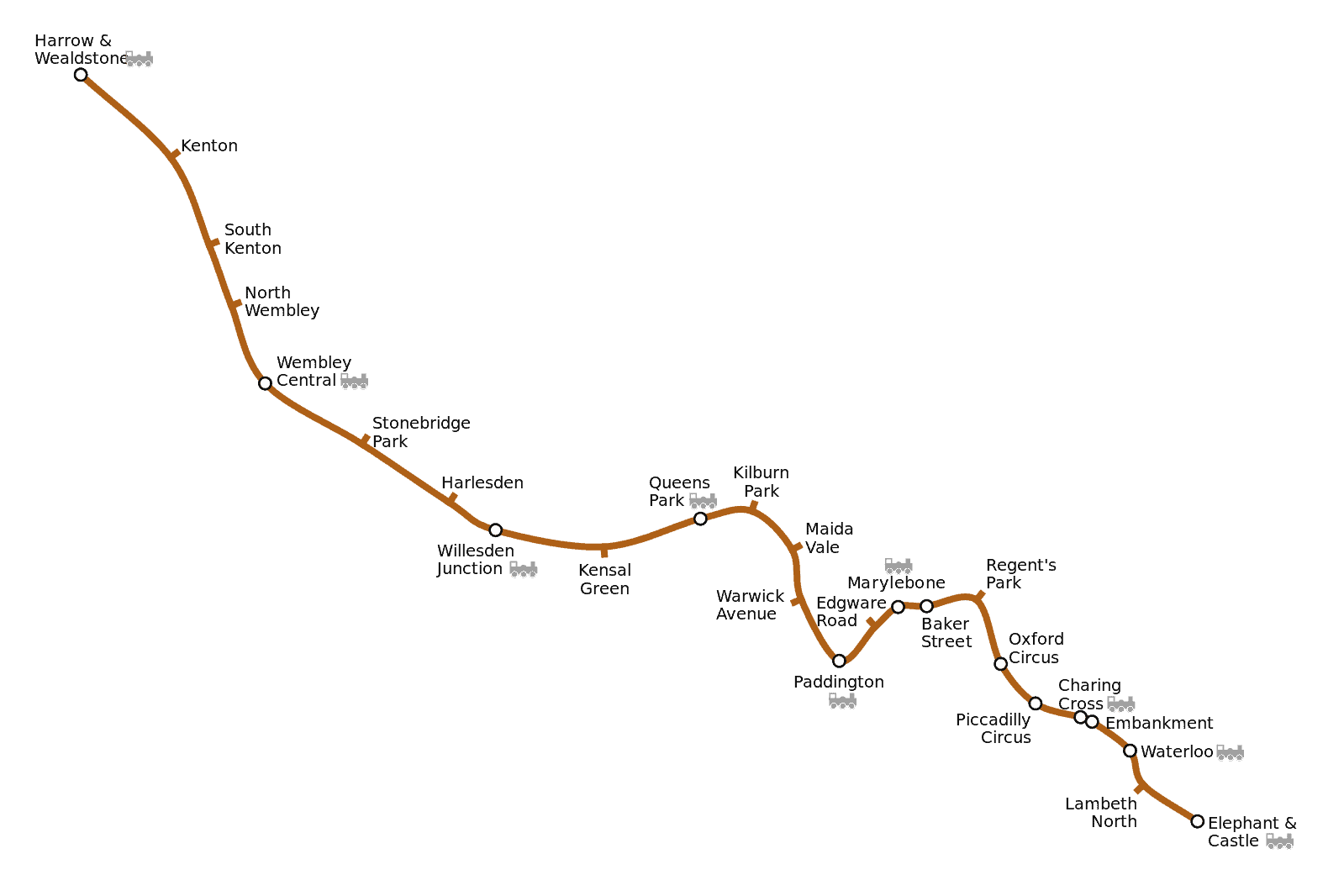
The Bakerloo line was believed to have been built because of the cricket games held at Lord’s Cricket Ground.
It was first opened to the public in 1906, with Elephant & Castle station as the first station to open. The last extension made for the line was in 1917.
Today, it services 25 stations as a rapid transit train under the London Underground.
The line spans a length of 23.2 km or 14.4 mi and runs an average train speed of 27.04 km per hour.
Moreover, Stonebridge Park, London Road, and Queen’s Park serve as its depots.
Central Line
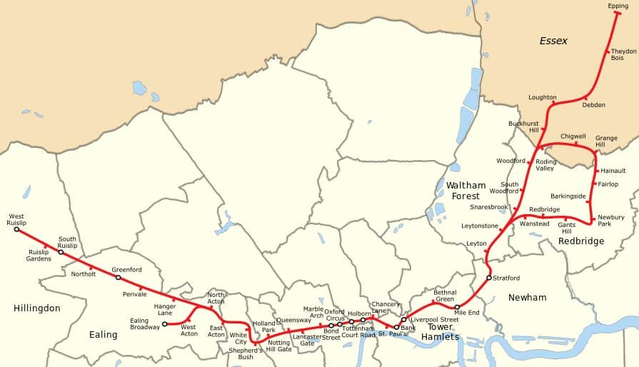
The Central Line officially opened in 1900 as Central London Railway originally.
It was Central London’s first operating tube and is considered the most bustling line of the London Underground.
More than 260 million passengers use the Central Line annually to travel through London from the northwest to the northeast.
Epping in Essex, Ealing in the London Borough of Ealing, and Ruislip in the London Borough of Hillingdon are all connected through the Central Line.
It is the longest line of the London Underground, spanning a length of 46 miles or 74 kilometers.
Moreover, it utilizes three traction maintenance depots: Ruislip, Hainault, and White City.
Circle line
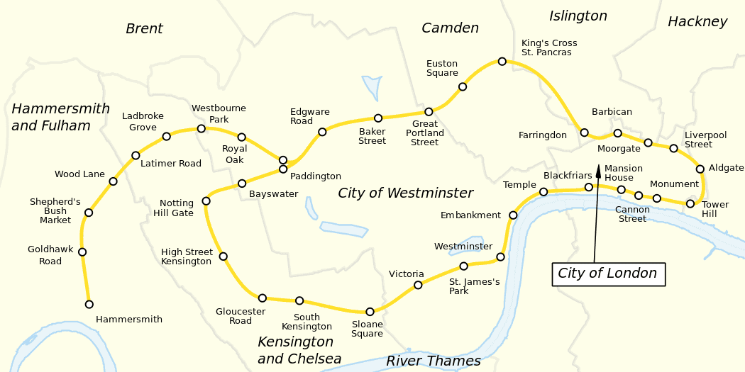
The Circle line began its first circular service in 1884 and only got its name written on posters in 1936.
It was only in 1949 that the line had its own line appear on the Tube map.
Today, the line serves 36 stations, of which Hammersmith is its depot.
It spans a total length of 27 km or about 17 mi. Moreover, its last extension was made on 13 December 2009.
To find the Circle line on the map, look for a yellow-coloured line.
District Line
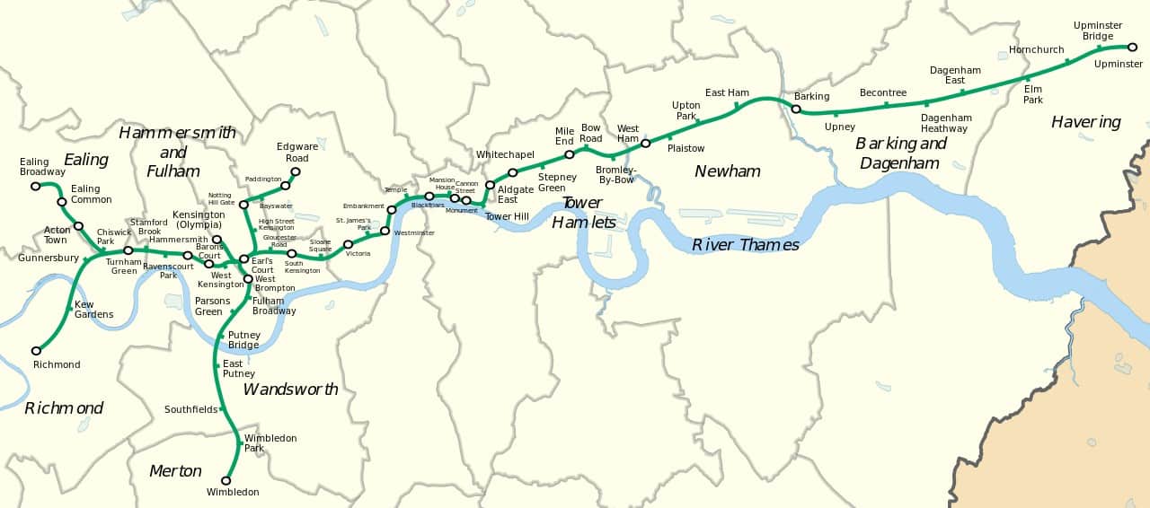
District Line is a rapid transit public transportation as part of the London Underground train system.
It opened in December 1868, servicing the east and west regions of London.
The London Boroughs it covers are Ealing, Richmond, Hammersmith and Fulham, Merton, Wandsworth, Tower Hamlets, Newham, Barking and Dagenham, and Havering.
The main tube line runs through several branches, including lines to Wimbledon, Edgware Road, Kensington (Olympia), Richmond, and Ealing Broadway.
Moreover, the depots it uses are Upminster Depot, Ealing Common Depot, and Lillie Bridge Depot.
It spans a length of 64 kilometers or about 40 miles used by more than 200 million passengers every year.
Hammersmith & City line
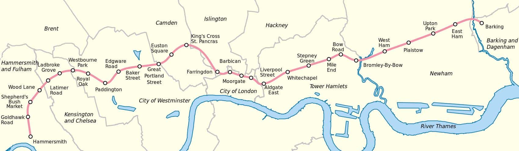
The Hammersmith & City line opened as Metropolitan Railway in 1863 before being renamed to its current name in 1990.
It first ran services between Farringdon and Paddington, followed by Hammersmith, and then Addison Road. In 1884, the line extended to Whitechapel and became electrified in 1906.
Today, it services 29 stations and is printed as a pink-coloured line on the Tube map. The line has an average train speed of 25.33 km per hour and a line length of 25.5 km or 15.8 mi.
Moreover, it is the second least ridden line out of 11 Tube lines, with 61,000,000 trips per annum.
More about Hammersmith & City line
Jubilee line
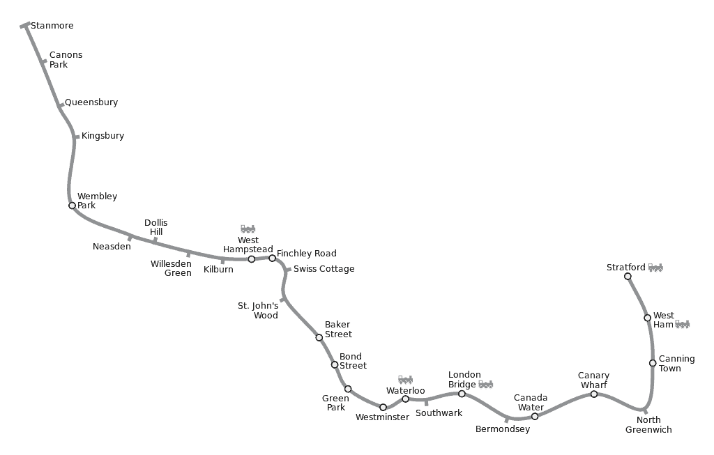
The Jubilee line is one of the 11 London Underground lines, which operates at 27 stations from Stanmore Underground Station to Stratford Underground Station.
It opened on May 1st, 1979, and now has a total line length of 36.2 km or 22.5 mi.
Today, more than 213 million people ride the Jubilee line every year.
If you are traveling on the Night Tube, it runs on the Jubilee line on Friday and Saturday evenings. Taxi ranks for the Night Tube are available at most Jubilee line stations.
Thanks to the 24-hour weekend service on the Night Tube and the abundance of taxi ranks, you don’t have to worry about traveling late at night via the Jubilee line.
Metropolitan line
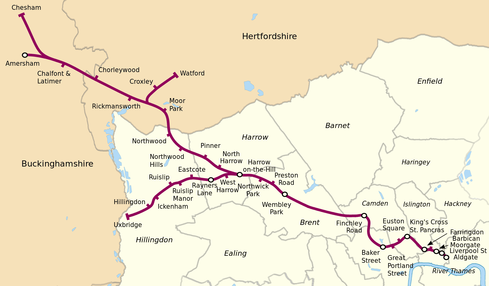
The Metropolitan line, also known as the Met, is the oldest underground railway in the world.
It took about two years to construct before officially opening in January 1963 and it was originally known as the Metropolitan Railway.
Moreover, it first ran services between Paddington and Farringdon, before extending from Baker Street to Swiss Cottage in 1868.
The line further extended to Aylesbury in 1892 and then to Uxbridge in 1904. In 1905, it innovated by having its first electric trains.
Today, the Met provides train services to 34 stations as rapid transit and suburban rail.
It spans a length of 67 km or 42 mi and runs at an average speed of 45.61 km per hour.
Northern Line
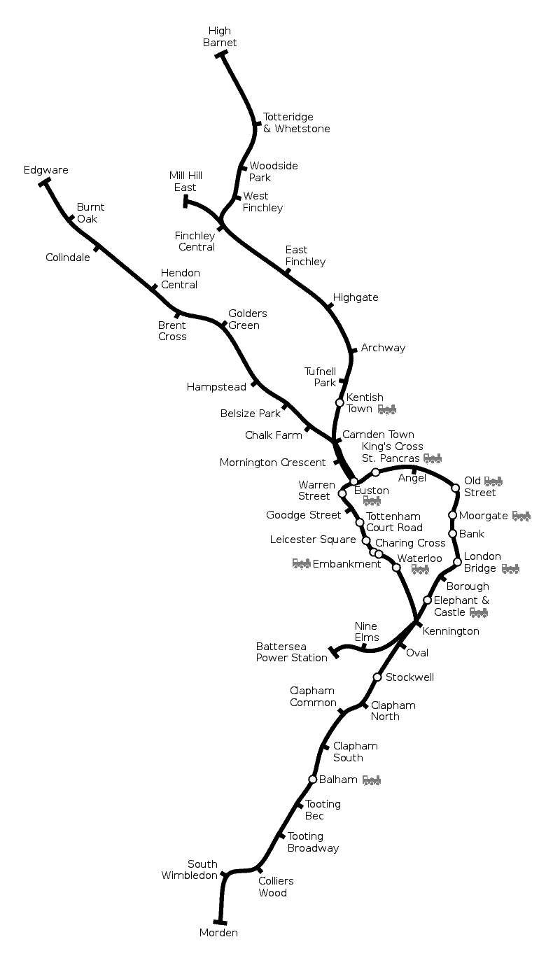
Opened in January 1890, the Northern line is one of the 11 London Underground lines.
It services 52 stations, with an annual ridership of 252.310 million passenger journeys.
Moreover, it spans a total length of 58 km or about 36 mi, running at an average speed of 33.28 km per hour or about 21 miles per hour.
Piccadilly line
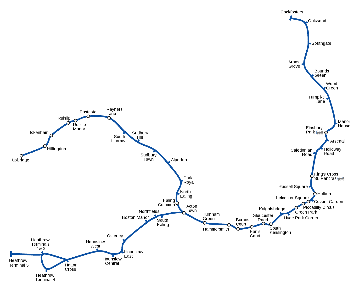
The Piccadilly line opened to the public in 1906, with its last extension on March 27, 2008.
It currently has 53 stations and a total length of 45.96 mi or 73.97 km. Cockfoster and Northfields stations are its depots.
In a year, it garners a total annual ridership of about 210.169 million passenger journeys.
According to Transport for London, the average speed of the Piccadilly line is 33.11 km per hour.
If you are to look for the line in the Tube and Rail map, it is identified with a dark blue line, officially “Corporate Blue” Pantone 072 colour.
Victoria line
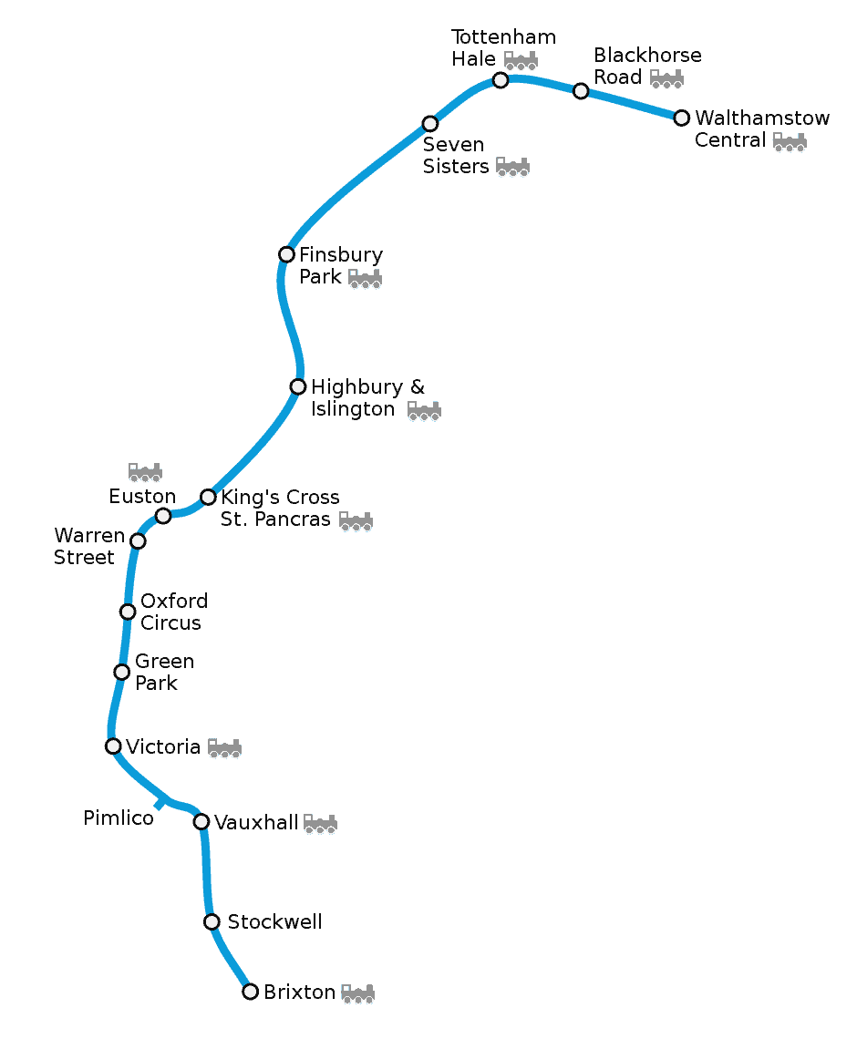
The Victoria line opened to the public in September 1968 and made its last line extension in 1971.
The reason for its construction was to mainly connect four terminals: Euston, St. Pancras, King’s Cross, and Victoria.
It serves 16 stations and is a rapid transit train part of the London Underground.
Moreover, it ranks as the fourth busiest among the 11 lines, with an average trip per annum of 263,400,000.
In total, it has a line length of 21 km or 13 mi and an average train speed of 40.66 km per hour.
One interesting fact about the line is that it was the world’s first automatic passenger railway with its Automatic Train Operation system (ATO).
Waterloo & City line
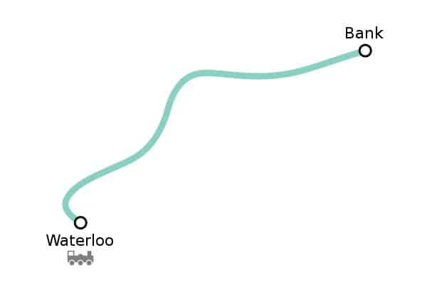
The Waterloo & City line, also known as “The Drain”, opened for public use in August 1898.
It was the second deep-level Tube made in London after the Northern line, another line of the Tube and was the first deep-level Tube in 1890.
The line used to be under the British Railways in the post-war years.
In April 1994, the line was transferred and included in the London Underground lines.
Today, the line services two stations as a rapid transit line, spanning a line length of 2.37 km or 1.47 mi.
It has an average train speed of 33.3 km per hour, a speed that is almost the same as the Northern line at 33.28 km per hour and the Piccadilly line at 33.11 km per hour.