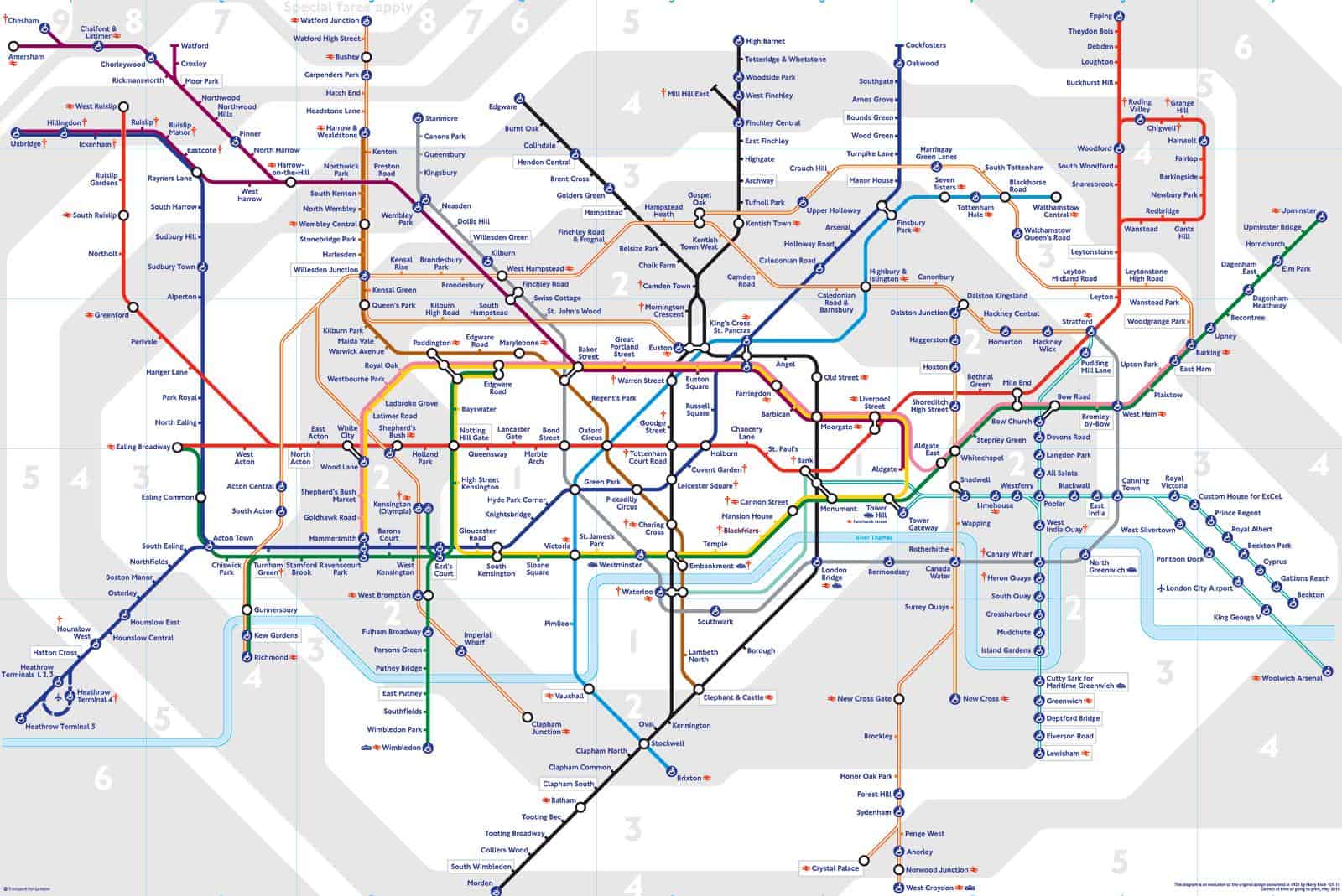
Download the London Underground Map (with elizabeth line) from the following link.
From the page 2 of the PDF map, you can see the stations and what zones the stations belong to.
In fact, I personally don’t recommend to print it out. You need a printer that you can print in different colours so that the colourful lines can be recognised.
If you print it using the black and white printer. I don’t think you can identify which tube lines they are since they are all in black colours.
Try to download the map which is in white and black colour. It make it easier to identify the tube lines if you print it out using the general printer. But you may need a big paper than A4 to print it.
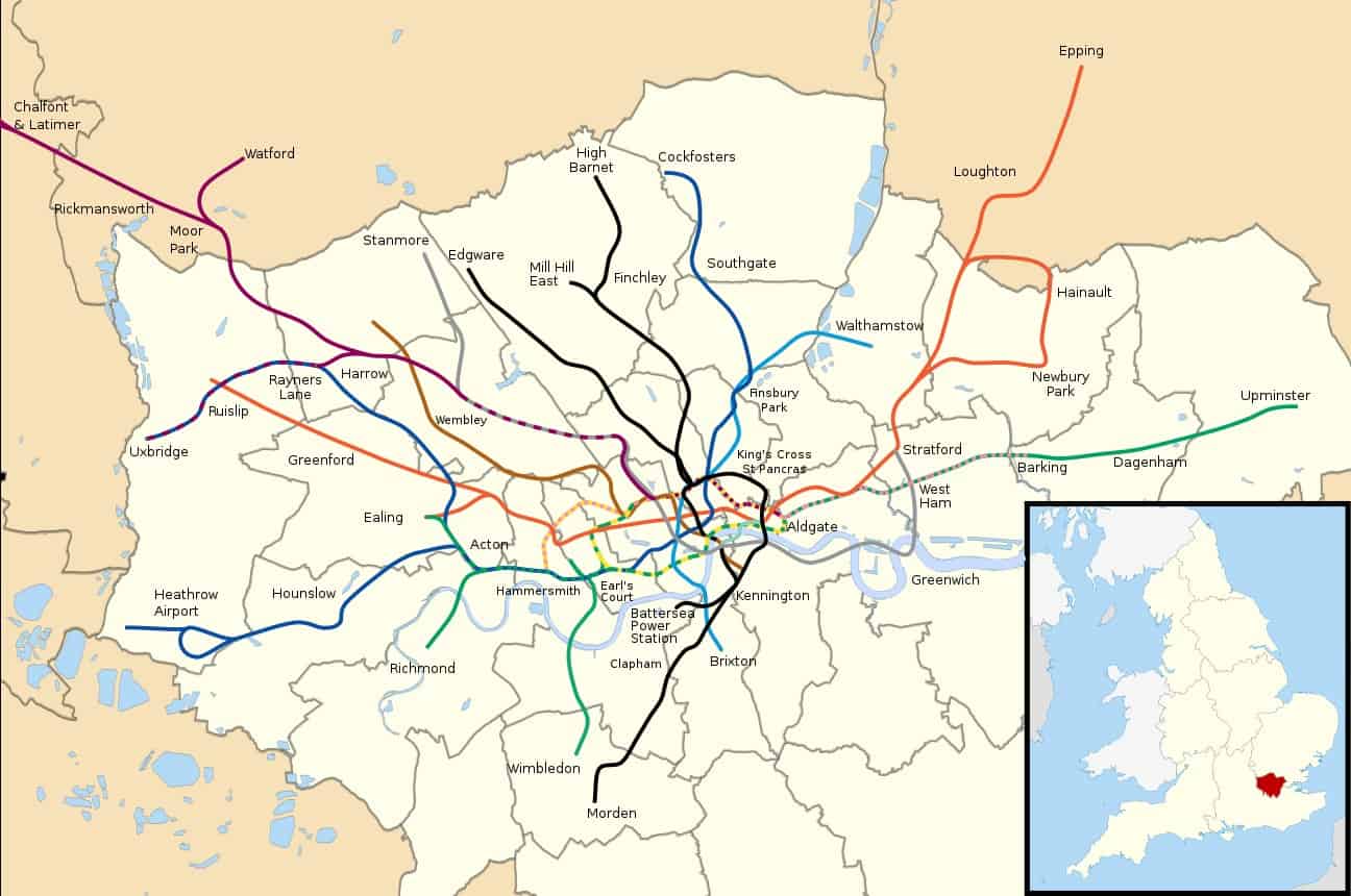
(London Tube Map by Edgepedia via Wikimedia Commons)
Understanding the London Tube Map
How does the London Underground work?
Before going on a journey using the London Underground, the first thing you need to learn is how to use the London Underground Map.
(London Tube Map by Edgepedia via Wikimedia Commons)
Some first-time travelers find the map confusing with its interconnected 11 Tube lines, as well as interchanges with other public transportation such as the DLR, Elizabeth line, London Overground, London Trams, Emirates Cable Car, and Thameslink.
When you look at the London Tube Map(PDF), you will find several colored lines forming the public transportation network. Moreover, you will also notice that there are numbered areas on the map, from numbers 1 to 9, which are in white and grey colours.
These numbers are called Zones or fare zones that are assigned to each station to determine the exact fare of your journey.
Basically, the more zones you travel to, the higher the fare. Most people find it easy to use the London Underground when traveling through only one line.
However, traveling through multiple transfers to other Tube lines or public transportation can be a bit tricky for some.
To help you commute using the London Underground Map, here is a quick summary of how to use the map with ease.
- Determine your start and end stations and their Tube lines on the map.
- Know which Zones you are traveling to by looking at the shaded gray and white areas with large numbers on the map. If your station falls within the white or gray borders of that Zone, then that is the Zone number of the station. You can also know the Zone number on the second page of the London Tube Map(PDF) which has the list of stations, facilities, and Zones.
- Look for the color of the Tube line on the map.
- Follow the Tube line to know which stations are between your start and end stations.
- When you see a white circle on the line, it indicates that the station has an interchange with another line. This means you can alight at the station and transfer to another line within the same station.
- Check which facility is available at the station by finding the symbols. The symbols indicate whether it has step-free access, transportation interchange, shirt walk between stations, and many more.
TfL provides different types of Tube map guides for a better commute experience.
Whether you need a Step-free Tube guide, a Tube map showing tunnels, or a Toilet facilities Tube map, you can download all the map guides in PDF through TfL.


Why isn’t the Elizabeth Line shown on the map?
Hi Sharon,
You can find the Elizabeth Line in the downloadable map. You can’t find it in the Wikimedia map since Elizabeth Line is new.