England, Scotland, Wales, and Northern Ireland comprise the United Kingdom (UK). Check the maps below to see the UK counties.
Click the images to see the high-resolution UK counties map. You can save the maps and print them out as you need.
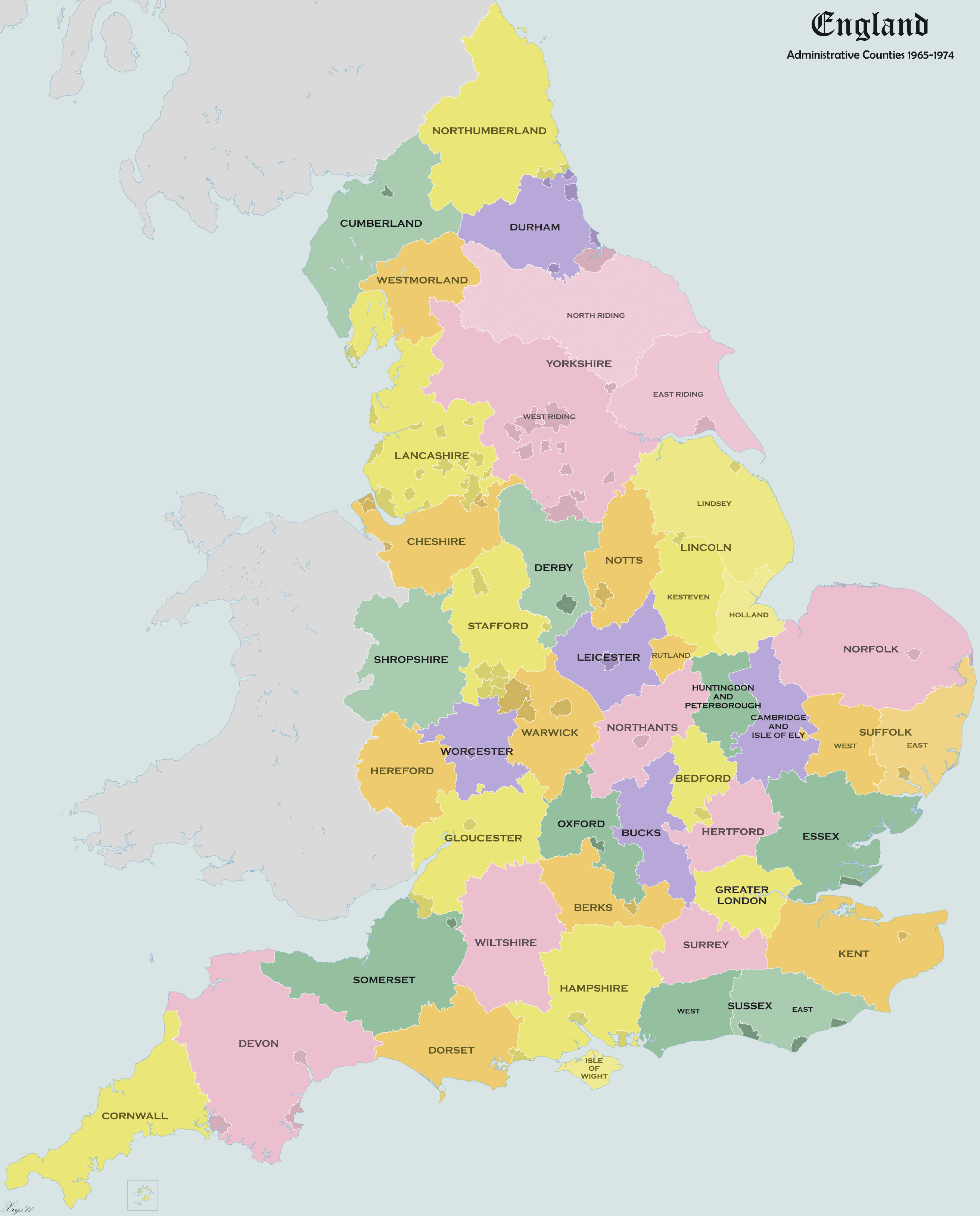
(England Admin Counties 1965-1974 Map by XrysD via Wikimedia Commons)
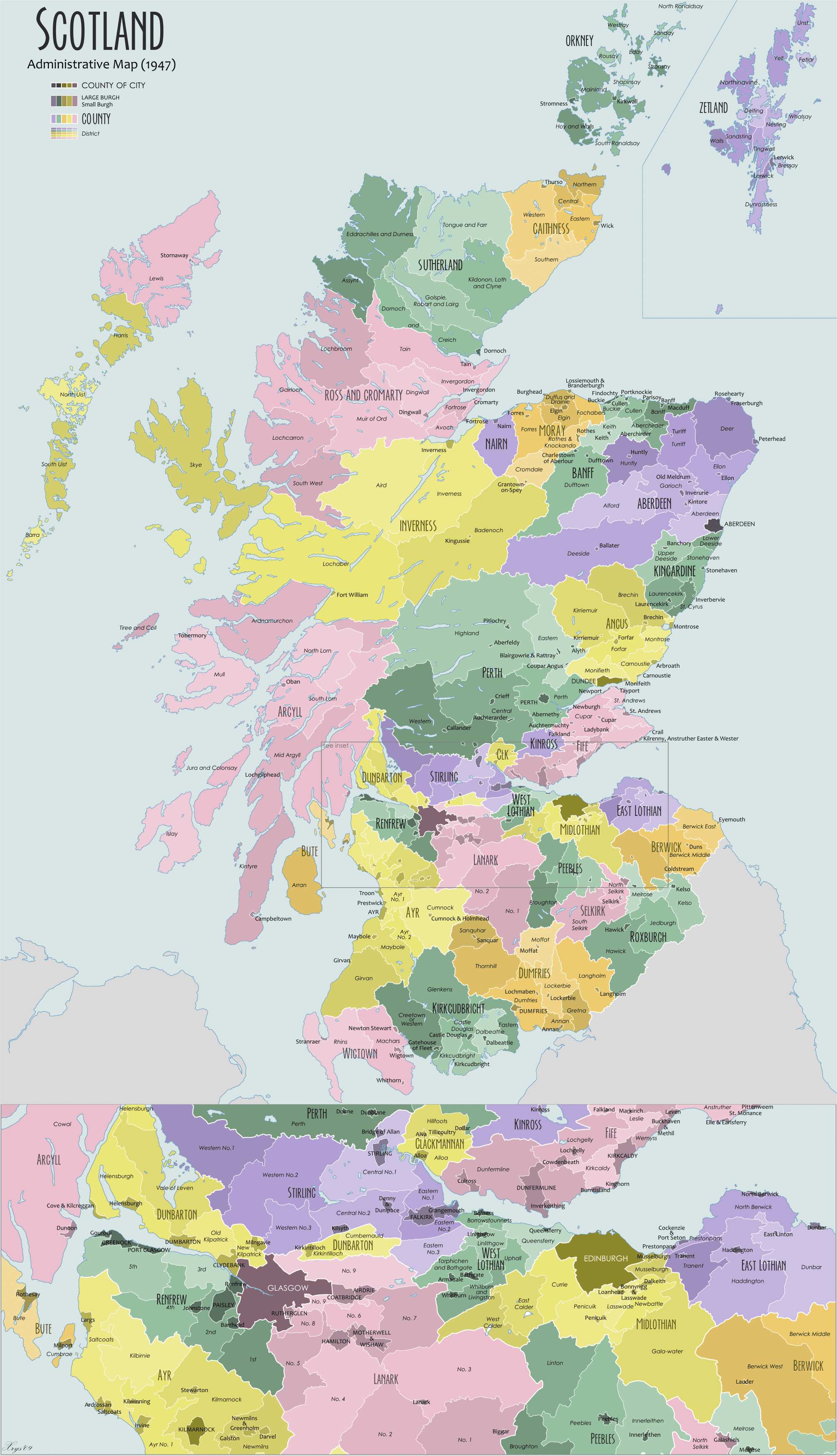
(Traditional Counties of Scotland Map via Wikimedia Commons)
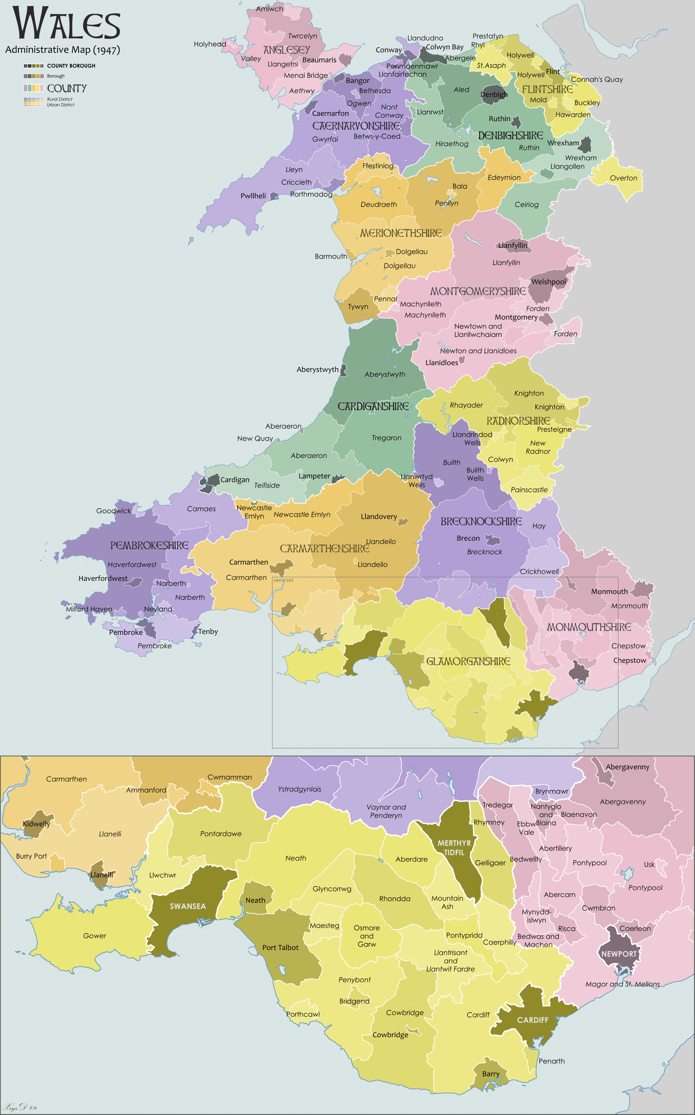
(Wales Administration Map by XrysD via Wikimedia Commons)
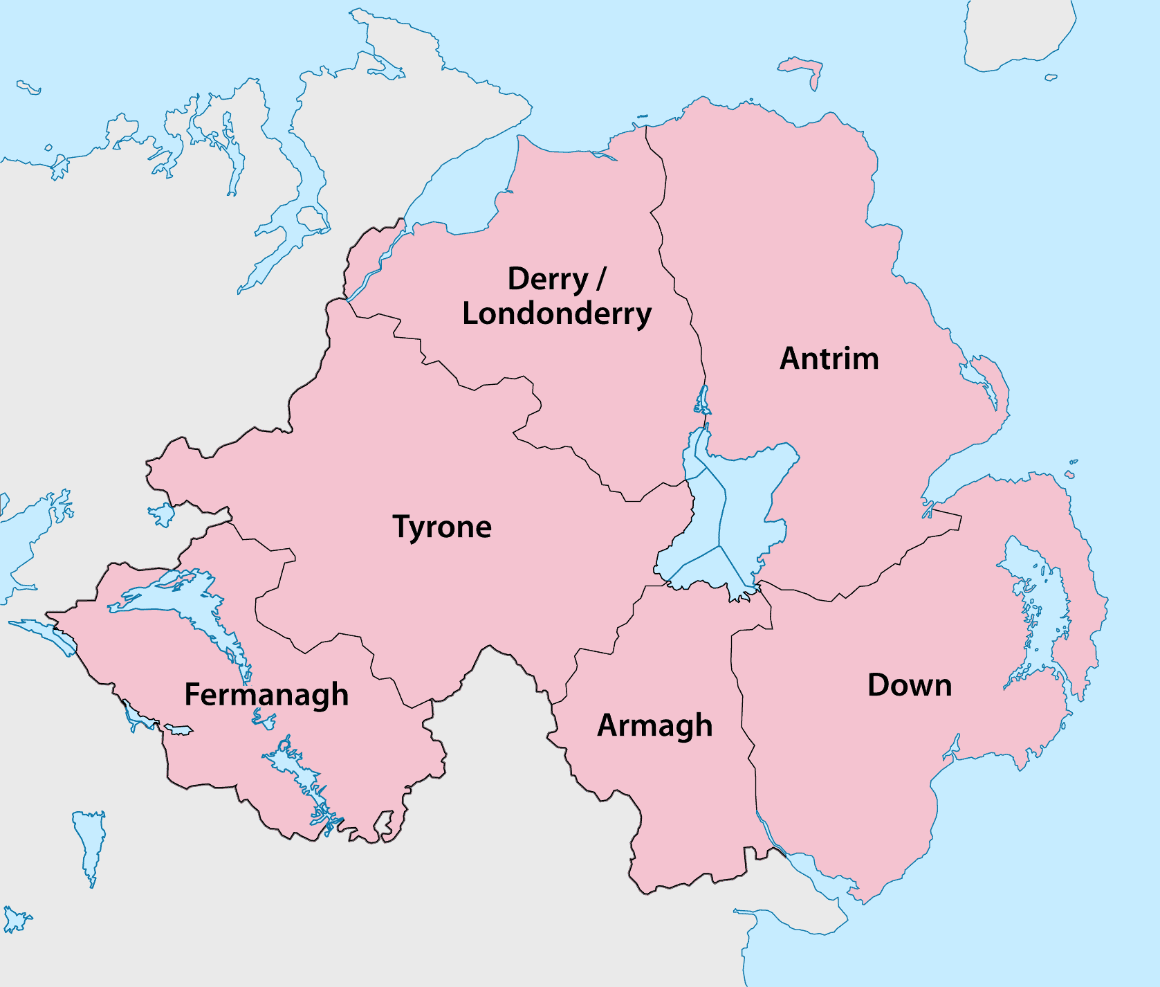
(Northern Ireland Counties Map by Chumwa via Wikimedia Commons)