Need a road trip getaway to relax? Or are you tired of the typical London hustle and bustle and desire a change of scenery?
Why not drive through the best scenic drives near London, just an hour or two away?
See stunning beaches, gorgeous villages in the countryside, and majestic historical castles, all accessible within just a few hours’ drive.
The scenic routes listed below include places along the way that are worth seeing, whether you prefer to simply view it from the car or stop by for pictures.
You can combine the sites listed in this article into one trip to spend over the weekend or even a week.
On top of that, the article lists the top essential things to bring for a road trip and nice-to-know reminders before hitting the road.
In a nutshell, the 10 Scenic Drives Near London For a Road Trip are as follows:
- From London to Windsor
- From London to Brighton
- From London to the Cotswolds
- From London to Cambridge
- From London to the Surrey Hills
- From London to Stonehenge
- From London to the White Cliffs of Dover
- From London to Kent
- From London to Wiltshire
- From London to Mersea Island
Contents
- 1 1. From London to Windsor
- 2 2. From London to Brighton
- 3 3. From London to the Cotswolds
- 4 4. From London to Cambridge
- 5 5. From London to the Surrey Hills
- 6 6. From London to Stonehenge
- 7 7. From London to the White Cliffs of Dover
- 8 8. From London to Kent
- 9 9. From London to Wiltshire
- 10 10. From London to Mersea Island
- 11 What You Need to Pack
- 12 Know Before Driving in London
1. From London to Windsor
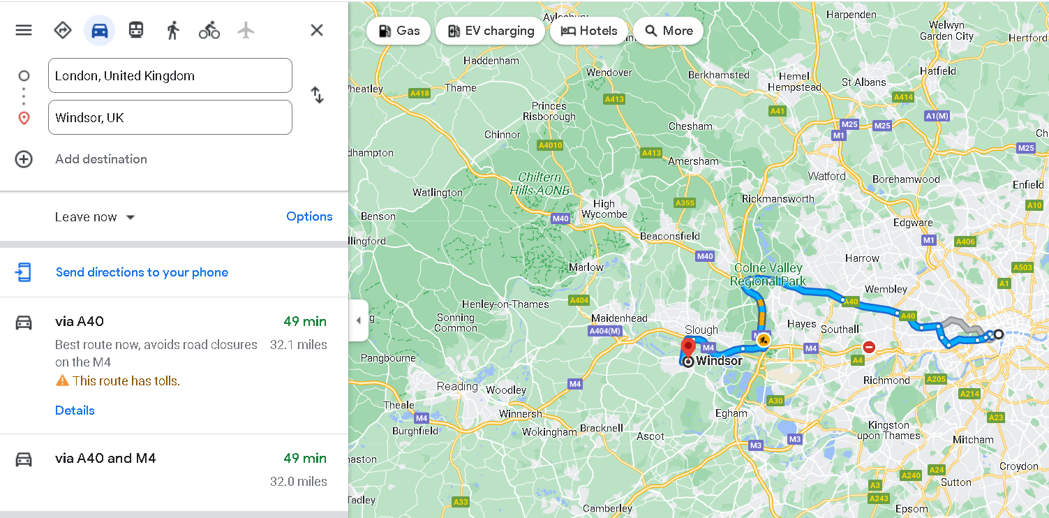
Distance from Central London: 24.9 miles
Travel Time: 53 minutes
Directions:
- Follow A4 to M4 for 30 min (7.4 mi)
- Follow M4 to A355 in Slough
- Keep right to continue on M4f
- Follow signs for Heathrow Arpt/Staines/Hounslow
- Take exit 6 from M4 for 18 min (15.5 mi)
- At junction 6, take the A355 exit to Slough/Central/Windsor/A332
- Take Royal Windsor Wy/A332 to Clarence Rd in Windsor
- At the roundabout, take the 1st exit onto A355
- Continue onto Royal Windsor Wy/A332
- Turn left onto Clarence Rd and you will reach Windsor
As you drive through London going to Windsor, you will be able to pass by vast lush greenery such as Hyde Park and Royal Botanic Gardens, Kew.
Passing along M4 offers several attractions worth stopping by, including National Trust – Osterley Park and House, Chiswick House and Gardens, and Gunnersbury Park.
You may not be able to get a good look, but a long stretch of green parks and golf clubs can be seen as soon as you get to the London Orbital Motorway.
The motorway is dominated by Harmondsworth Moor, Thorney Country Park, and Richings Park.
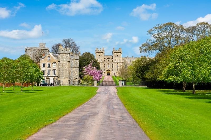
The best part of the drive is upon reaching Windsor itself. Windsor is a town along the banks of the River Thames that is famous for the beautiful Windsor Castle, historical Frogmore Cottage, and Dorney Lake
2. From London to Brighton
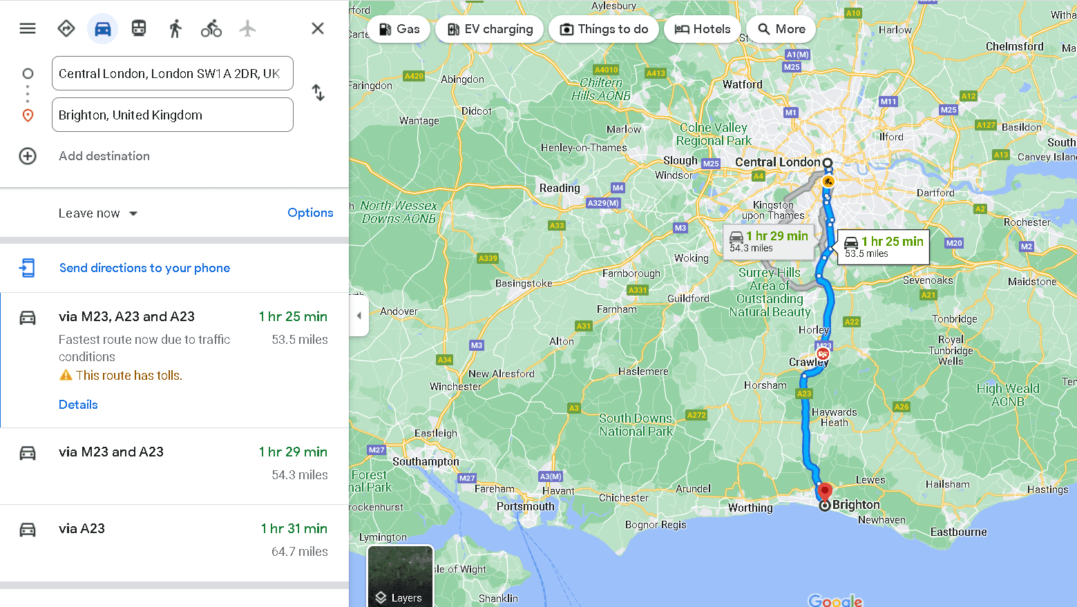
Distance from Central London: 53.8 miles to 64.4 miles
Travel Time:2 hours and 2 minutes to 2 hours and 14 minutes
Directions:
Via A23
- Take A3212, A302, Parliament Sq (entering toll zone)
- At the roundabout, continue straight onto Greycoat Pl/B323
- At the roundabout, take the 1st exit onto Rochester Row/B324 (leaving the toll zone)
- At the roundabout, take the 2nd exit onto Ebury Bridge
- Continue onto Pimlico Rd/A3214
- Continue onto Royal Hospital Rd/B30216 min (2.8 mi)
- Take A3, A243, M25, M23 and A23 to your destination in Brighton
Via M23, A23 and A23
- Take A3212 and A302 to Peckham – Camberwell – Vauxhall – Westminster Hwy/A202/A3036 in Vauxhall
- Follow A23, M23 and A23 to Brighton
- Turn left to reach Brighton
Via M23 and A23
- Take A3212 and Albert Embankment to Peckham – Camberwell – Vauxhall – Westminster Hwy/A202/A3036 in Vauxhall
- Take S Lambeth Rd, Clapham Rd/A3, B221 and A23 to Streatham High Rd/A216 in Streatham
- Take A237 to Brighton Rd/A23 in Coulsdon
- Follow M23 and A23 to Brighton
- Turn left to reach Brighton
Brighton is situated on the South Coast, south of Central London. It is a perfect coastal town for a seaside getaway that passes through other scenic places such as Surrey Hills and South Downs.
If you have time to spare, you can drop by Surrey Hills, one of the best places for a scenic drive, to make the most of your road trip.
You can also pass by Battersea to get picturesque views of the River Thames and then head to Mitcham Common to relax in the nature preserve.
Once you reach Crawley, it sure is a break from the city with the Giant Oak, Worth Forest, and several nature preserves and gardens along M23.
Once you reach Brighton, you’ll be transported to the Bronze Age, Roman, and Anglo-Saxon periods with several historical sites, such as the Royal Pavilion.
Moreover, you’ll enjoy breathtaking views from Brighton Palace Pier, Brighton i360, and Brighton seafront.
3. From London to the Cotswolds
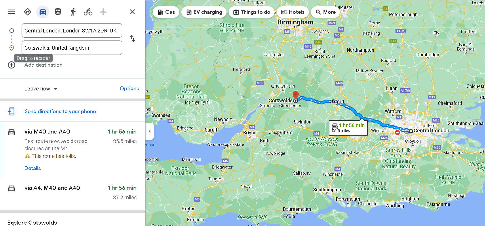
Distance from Central London: 85.5 miles to 102 miles
Travel Time: 2 hours and 8 minutes to 2 hours and 13 minutes
Directions:
Via M4
- Follow A4 to M4
- Follow M4 to Swindon
- Follow signs for Heathrow Arpt/Staines/Hounslow
- Keep right to stay on M4
- Take exit 15 from M4
- At junction 15, take the A346/A419 exit to Marlborough/Swindon
- Follow A419, A417 and A429 to your destination in Cotswolds
Via M40 and A40
- Take The Mall and Constitution Hill to Duke of Wellington Pl
- Follow A40, M40 and A40 to Gloucestershire
- Drive to Cotswolds
Cotswolds is located west of Central London, just 5.5 miles to 102 miles away.
The route to Cotswolds is among the best since you will pass through lovely towns in Oxford and Notting Hill.
If you choose another route, you can also drop by and appreciate the beautiful English countryside in Reading and Slough.
Outdoor and nature lovers, as well as history buffs, will truly relish the sites in Cotswolds.
From Cotswolds AONB to the beautiful Cotswolds villages and 4th-century National Trust – Chedworth Roman Villa, it is definitely worth the drive.
You can also find the Chedworth Village Hall and 17th-century National Trust – Lodge Park and Sherborne Park Estate.
4. From London to Cambridge
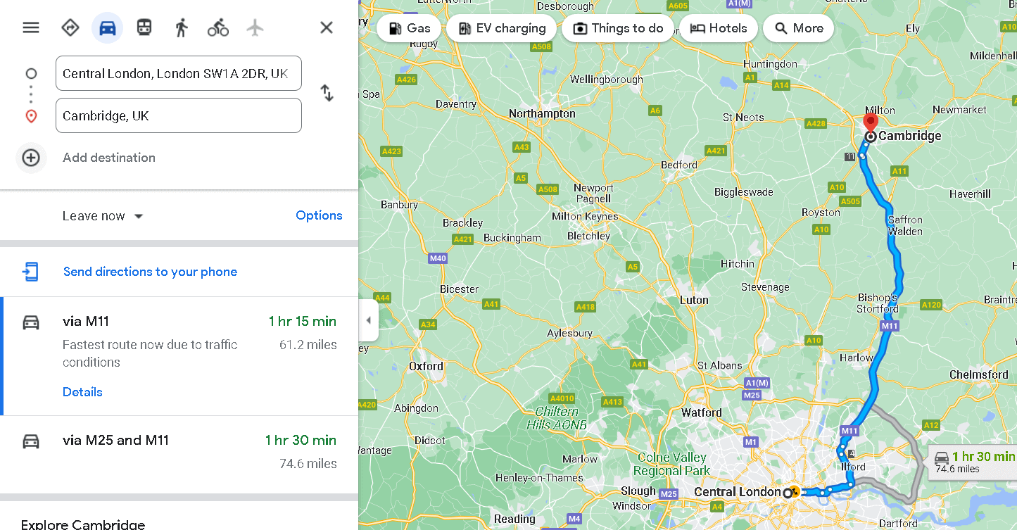
Distance from Central London: 60.2 miles to 61.4 miles
Travel Time: 1 hour and 34 minutes to 1 hour and 55 minutes
Directions:
Via M11
- Get on M11 in Woodford from A3211, A1203, A13 and N Circular Rd/A406
- Follow M11 to Cambridgeshire
- Take exit 11 from M11
- At junction 11, take the A10 exit to Cambridge(South)/A1309/Harston
- Continue on A1309.
- Take Trumpington Rd/A1134 to Hills Rd/A1307 in Cambridge
- Turn right onto Brooklands Ave
- Turn left onto Hills Rd/A1307
Via N Circular Rd/A406 and M11
- Get on M11 in Woodford from A3211, A1203, A1261, A13
- Take the M11 ramp to Cambridge/Stansted Arpt
- Follow M11 to Cambridgeshire.
- Take exit 11 from M11
- At junction 11, take the A10 exit to Cambridge(South)/A1309/Harston
- Continue on A1309
- At the roundabout, take the 3rd exit onto Hauxton Rd/A1309
- Take Trumpington Rd/A1134 to Hills Rd/A1307 in Cambridge
Via A1(M)
- Take A4201, Outer Cir and Avenue Road to Adelaide Rd/A41
- Continue on A41
- Take A1, A1(M), A505 and A10 to Hauxton Rd/A1309 in Cambridgeshire
- Continue on A1309
- Take Trumpington Rd/A1134 to Hills Rd/A1307 in Cambridge
Cambridge is a famous university city located north of Central London, about 60.2 miles to 61.4 miles away.
It is considered one of the most beautiful cities in the country with its awe-inspiring architecture.
The route to Cambridge involves passing through quaint towns in Notting Hill, Finchley, Borehamwood, Hatfield, Old Knebworth, Royston, and Foxton.
It is highly recommended to drop by Hatfield, home to the historic Hatfield House, then to Welwyn to see the National Trust – Shaw’s Corner, and lastly, to Hitchin to see St Paul’s Walden Bury.
Upon reaching Cambridge, don’t forget to visit The Fitzwilliam Museum, Cambridge Museum of Technology, and Kettle’s Yard.
Of course, it is a must to take pictures at Instagrammable and historical sites like the prestigious University of Cambridge and Castle Mound.
5. From London to the Surrey Hills
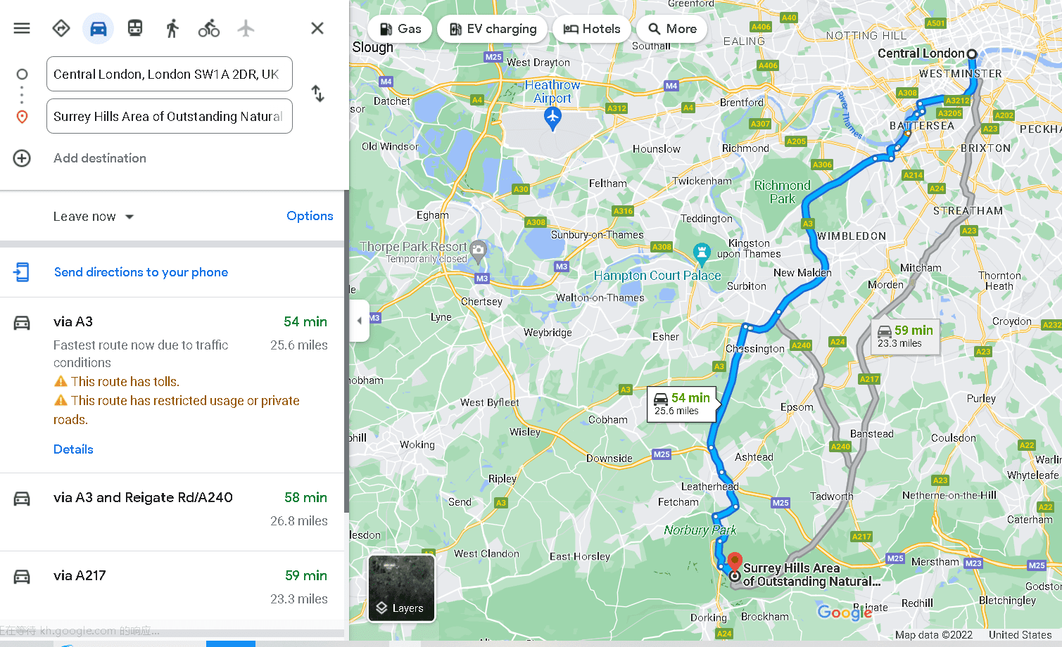
Distance from Central London: 25.4 miles to 43.2 miles
Travel Time: 1 hour and 18 minutes to 1 hour and 21 minutes
Directions:
Via A3
- Take A3212, A302, Rochester Row/B324, Warwick Way
- Take Royal Hospital Rd/B302 to Chelsea Embankment/A3212 in Chelsea
- Turn right onto Chelsea Embankment/A3212
- Take B305 to York Rd/A3205 in Battersea
- Take A3, A243 and Leatherhead By-Pass Rd to Old London Rd/B2209 in Mickleham
- Turn left onto Old London Rd/B2209
- Turn left onto Zig Zag Rd
Via M25
- Follow A4, A315 and A4 to M4
- Follow M4 and M25 to A243 in Leatherhead
- Take exit 9 from M25
- Take Leatherhead By-Pass Rd to Zig Zag Rd
Via M4 and M25
- Follow A4 to M4
- Follow M4 and M25 to A243 in Leatherhead
- Take exit 9 from M25
- Take Leatherhead By-Pass Rd to Zig Zag Rd
For a shorter drive with unmatched views, go on a road trip to Surrey Hills. The shortest route is via A3, which is only a 25-mile distance.
As you head down south of Central London, you will pass by exceptional untouched beauty and several gorgeous villages in England.
Visit the Wimbledon and Putney Commons to relax in grassland, drop by the Hampton Court Palace to see the famous seat of Henry VII, or see the historic estate Polesden Lacey.
Surrey Hills boasts its Surrey Hills Area of Outstanding Natural Beauty, best known for its trails and mountain views.
Surrounding it are several parks and nature preserves such as Norbury Park – Viewpoint, London Viewpoint, Box Hill, National Trust – Box Hill, and Juniper Top.
6. From London to Stonehenge
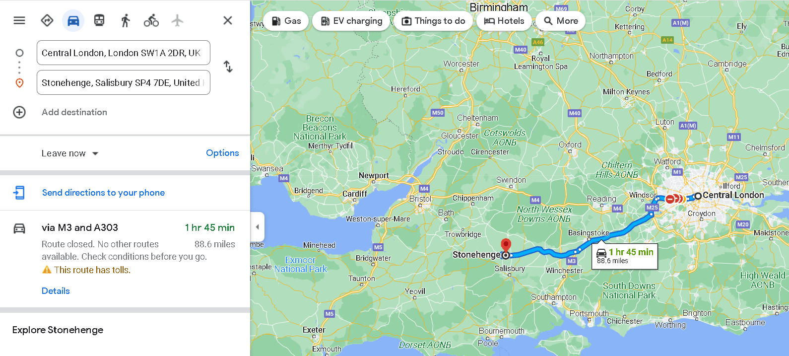
Distance from Central London: 88.8 miles to 108 miles
Travel Time: 2 hours and 1 minute to 2 hours and 42 minutes
Directions:
Via M3 and A303
- Take The Mall, Knightsbridge, Kensington Rd./A315 and A4 to M4
- Continue on M4
- Take M3 to A303 in Hampshire.
- Take exit 8 from M3
- Continue onto A303
- At Countess Roundabout, take the 2nd exit onto Amesbury Byp/A303
- Continue to follow A303
- At Longbarrow Roundabout, take the 3rd exit onto A360
- At Airman’s Corner, take the 3rd exit onto A344
- Turn right to Stonehenge
Via M4, M3 and A303
- Follow A4 to M4
- Continue on M4
- Take M3 to A303 in Hampshire
- Take exit 8 from M3
- Continue onto A303
- At Countess Roundabout, take the 2nd exit onto Amesbury Byp/A303
- Continue to follow A303
- At Longbarrow Roundabout, take the 3rd exit onto A360
- At Airman’s Corner, take the 3rd exit onto A344
- Turn right to Stonehenge
Via M4
- Follow A4 to M4
- Keep right to continue on M4, follow signs for Heathrow Arpt/Staines/Hounslow
- Keep right to stay on M4
- At junction 15, take the A346/A419 exit to Marlborough/SwindonTake exit 15 from M4
- Follow A346, A345 and The Packway to your destination in Wiltshire
One of the most iconic landmarks located west of London is Stonehenge, a mysterious legendary monument in Salisbury.
It is a must-visit World Heritage Site, just 88.8 miles to 108 miles from Central London.
If you take the M4 route, you can pass by the Surry Hills Area of Outstanding Natural Beauty first and then to the nearby mediaeval cities of Winchester and Salisbury.
The nearby mediaeval cities of Winchester and Salisbury are a must-visit for history enthusiasts.
Salisbury is a mediaeval cathedral city home to the Salisbury Church which houses the Magna Carta, just 9.6 miles to 12.5 miles away; whereas Winchester is 23 miles to 35.2 miles away and is a walk back in time with its 17th-century Morley Library, the ruins of Wolvesey Castle, and the mediaeval Winchester Cathedral.
Afterwards, you can head down south to Southampton to see the beautiful port city on the south coast, as well as the historic Portsmouth port city.
7. From London to the White Cliffs of Dover
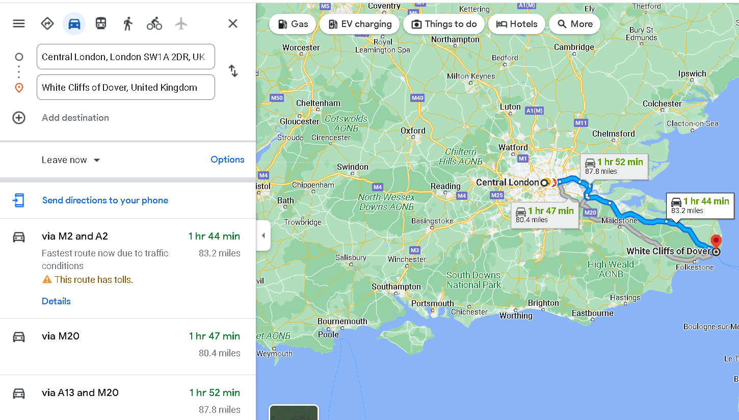
Distance from Central London: 78.8 miles to 83.2 miles
Travel Time: 1 hour and 44 minutes to 1 hour and 49 minutes
Directions:
Via M2 and A2
- Take A1203, A102 and A2 to M2 in Shorne
- Follow M2 and A2 to A258 in Guston
- Continue onto M2 (signs for Dover/Channel Tunnel/Canterbury/Chatham)
- At junction 7, take the A2 exit to Canterbury/Dover/Channel Tnl
- At Brenley Corner, take the 4th exit onto Boughton Bypass/A2
- At Whitfield Roundabout, take the 2nd exit and stay on A2
- Continue on A258
- At Duke Of York’s Roundabout, take the 3rd exit onto A258
- Turn left onto Upper Rd
Via A13, M2 and A2
- Get on A282 in Grays from A3211, A1203 and A13
- Follow A2, M2 and A2 to A258 in Guston
- Continue onto A282
- Keep right to stay on A282, follow signs for M20/M23/Gatwick Arpt/M25/channel Tunnel/Dover
- Keep right to stay on A282
- Use the left lane to take the A2 ramp to M2/Canterbury
- Keep left at the fork and merge onto A2
- Continue onto M2 (signs for Dover/Channel Tunnel/Canterbury/Chatham)
- At junction 7, take the A2 exit to Canterbury/Dover/Channel Tnl
- At Brenley Corner, take the 4th exit onto Boughton Bypass/A2
- At Whitfield Roundabout, take the 2nd exit and stay on A2
- Continue on A258
- At Duke Of York’s Roundabout, take the 3rd exit onto A258
- Turn left onto Upper Rd
Get majestic views of the Strait of Dover from the White Cliffs of Dover.
Surrounding the cliff are stunning historical landmarks, castles, and lighthouses, including the National Trust South Foreland Lighthouse, The Great Tower, Tower, SE&CR Historic Rail Terminal Building, Historic Dover, and Dover Castle.
For breathtaking views of the sea, you can visit Dover Beach and St Margaret’s Beach.
Take a break and have a good stretch at the beaches, which have several restaurants, coffee shops, and bars at the seaside.
The journey to the White Cliffs of Dover offers more scenic views from towns and cities you will pass through, including National Trust – Cobham Wood and Mausoleum in Rochester and the beauty of Kent Downs nature preserve.
From Central London, you will drive through Canary Wharf, Barking, Purfleet, over the River Thames, Dartford, Shorne, Rochester, Sittingbourne, Canterbury, Whitefield, and then to Dover.
8. From London to Kent
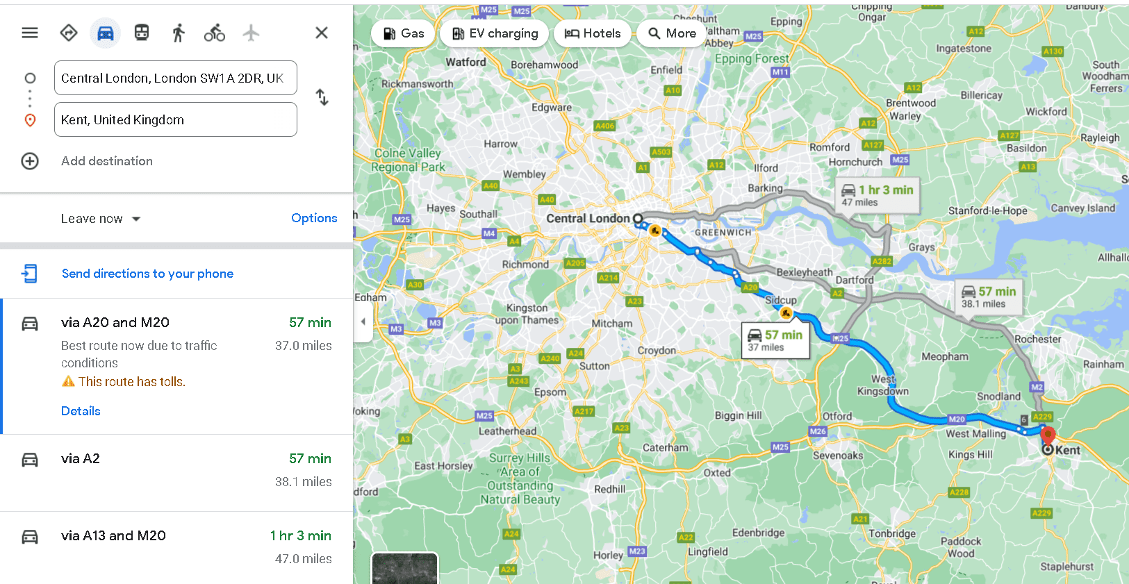
Distance from Central London: 37 miles to 39.6 miles
Travel Time: 1 hour and 6 minutes to 1 hour and 10 minutes
Directions:
Via A2
- Take A3211 to E Smithfield/A1203
- Head east on Northumberland Ave toward Great Scotland Yard
- Turn left onto Victoria Embankment/A3211
- Continue to follow A3211
- Continue onto Byward St/A100
- Continue on A1203
- Drive from A102, A2, M2 and A229 to Maidstone
- Take Sandling Rd/Week St to Kent
- Slight left toward Staceys St/B2012
- At the roundabout, take the 3rd exit onto Sandling Rd/Week St
- Turn right to Kent
Via A20 and M20
- Take A3212, A302 and Westminster Bridge Rd to New Kent Rd/A201
- Head east on Northumberland Ave toward Great Scotland Yard
- Turn right onto Great Scotland Yard
- Turn left onto Whitehall/A3212
- Continue to follow A3212
- Turn left onto Bridge St/A302
- Continue to follow A302
- Turn left onto Westminster Bridge Rd/A302
- Continue to follow Westminster Bridge Rd
- At the roundabout, take the 3rd exit onto St George’s Circus/A201
- Drive from A2, A20 and M20 to Maidstone
- Take Sandling Rd/Week St to Kent
- Slight left toward Staceys St/B2012
- At the roundabout, take the 3rd exit onto Sandling Rd/Week St
- Turn right to Kent
Via A2 and M2
- Take A3212, A302 and Westminster Bridge Rd to New Kent Rd/A201
- Follow A2, M2 and A229 to Maidstone
- Take Sandling Rd/Week St to Kent
- Slight left toward Staceys St/B2012
- At the roundabout, take the 3rd exit onto Sandling Rd/Week St
- Turn right to Kent
Before heading down to the White Cliffs of Dover, you will pass through Kent or also known as the Garden of England for having a plethora of hop gardens.
The county of Kent is the oldest in England and has a wealth of fascinating history.
It is home to the city of Canterbury, featuring Canterbury Cathedral with more than 1,400 years of history.
As you drive along M20, you will stumble upon Leeds Castle, a sight to behold known for having existed since 857 and a favourite residence of King Edward I in the 13th century.
After Leeds Castle, you can head down south to Kent Downs AONB and to the south coast.
The south coast has several beaches and attractions to explore, such as Hythe Beach, Folkestone Beach, and Dymchurch Amusement Park.
9. From London to Wiltshire
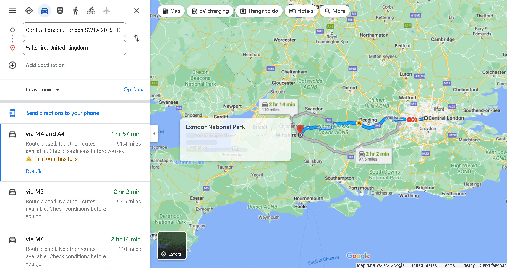
Distance from Central London: 91.4 miles to 110 miles
Travel Time: 2 hours and 8 minutes to 2 hours and 25 minutes
Directions:
Via M4 and A4
- Follow A4 to M4
- Follow M4 to A338 in Berkshire
- Keep right to continue on M4, follow signs for Heathrow Arpt/Staines/Hounslow
- Keep right to stay on M4
- At junction 14, take the A338 exit to Hungerford/Wantage
- Take exit 14 from M4
- Follow A338, A4 and A361 to Long St in Devizes
Via M3
- Continue to Knightsbridge
- Drive from M4, M3 and A303 to Andover
- Take the exit toward Ludgershall/Fyfield/Weyhill/Monxton/Portway Ind Est/Andover Business Pk from A303
- Follow A342 to A338 in Wiltshire
- Turn left onto A338
- Follow A342 to Long St in Devizes
Via M4
- Follow A4 to M4
- Follow M4 to A350 in Wiltshire
- Keep right to continue on M4, follow signs for Heathrow Arpt/Staines/Hounslow
- Keep right to stay on M4
- At junction 17, take the A350/A429 exit to Chippenham/Cirencester
- Take exit 17 from M4
- Continue on A350
- Take Malmesbury Rd/B4158, London Rd and A342 to Long St in Devizes
Wiltshire is a drive going west of London and takes 2 hours and 8 minutes to 2 hours and 25 minutes to reach.
It is a historic and ceremonial county perfect for history buffs, located in South West England.
If you are a Harry Potter fan, then you should not miss stopping by Lacock Abbey, a country house and historic village streets used as filming locations for Harry Potter and Downton Abbey.
In fact, the village of Lacock is one of the charming villages to visit, loved for its untouched buildings and houses.
Another similar village worth visiting is Avebury, best known for holding the largest megalithic stone circle in the world and an abundance of prehistoric monuments.
The scenic drive to Wiltshire is convenient since you can also pass by other picturesque spots, such as Surrey Hills, Salisbury, Winchester, and Cotswolds.
10. From London to Mersea Island
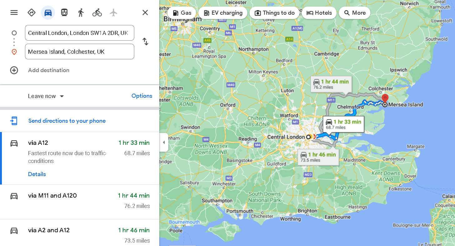
Distance from Central London: 68.7 miles to 73.5 miles
Travel Time: 1 hour and 43 minutes to 2 hours and 2 minutes
Directions:
Via A12
- Take A3211 to E Smithfield/A1203
- Head east on Northumberland Ave toward Great Scotland Yard
- Turn left onto Victoria Embankment/A3211
- Continue to follow A3211
- Continue onto Byward St/A100
- Follow A13, M25 and A12 to Oak Rd in Essex
- Take Braxted Park Rd, Maldon Rd/B1022, Barnhall Rd, Colchester Rd/B1026, and lastly to Peldon Rd to E Mersea Rd
Via M25 and A12
- Get on M11 in Woodford from A3211, A1203, A1261, A13, and Exit 4
- Take the M11 ramp to Cambridge/Stansted Arpt
- Continue onto M11
- At junction 6, exit onto M25 toward M20/Gatwick Arpt/Dartford Xing
- At junction 28, Use the left 2 lanes to take the A12 W exit to A1023/Romford
- Enter the roundabout
- Exit the roundabout onto the A12 ramp to Chelmsford/Harwich/A120
- Keep right at the fork and merge onto A12
- Take Braxted Park Rd, Maldon Rd/B1022, Barnhall Rd, Colchester Rd/B1026 and Maldon Rd to E Mersea Rd
Via A2 and A12
- Get on A282 in Dartford from A2
- Take M25 and A12 to Oak Rd in Essex
- Take Braxted Park Rd, Maldon Rd/B1022, Barnhall Rd, Colchester Rd/B1026, and Peldon Rd to E Mersea Rd
The last on the list is the scenic drive to Mersea Island on the eastern end of England, about 1 hour and 43 minutes to 2 hours and 2 minutes drive.
Mersea Island is a go-to destination for all things seafood and beaches.
You can take a break from a long drive with its many restaurants and pubs and, of course, the lovely beach views.
Mersea Island is loved for its peaceful atmosphere and charming fishing villages that are pretty as a picture.
Aside from beaches, you can also take a walk on walking trails at Cudmore Grove Country Park, Grazing Marsh, and East Mersea Flats Nature Reserve.
The route to the island allows you to explore other captivating places, such as Canary Wharf, Greenwich, the historic Chelmsford, and Peldon.
What You Need to Pack
Best to be fully equipped before hitting the road. Make sure you have all the road trip essentials by preparing a packing list.
Major and minor situations can happen anytime, so it is best to come with all the necessary things, whether for an emergency or small cravings.
Moreover, you may be passing highways or roads without any stores, groceries, or restaurants.
Thus, having your own supply of food and equipment is better, lessening your worries and the hassle of finding a store.
To avoid rushing at the last minute, it is highly recommended to pack the night before the trip. Packing in advance helps avoid forgetting one or two items.
Moreover, packing ahead of time lets you know which items you lack so that you can buy them at the store before the trip.
Here is a handy list of things you need for a road trip to have a smooth adventure. Whether you are going for just a day or a week, this packing list will come in handy.
- Car charger and power bank to keep your phones and cameras juiced up
- Your favourite snacks and drinks, most importantly, water
- Pillows and blankets for comfort
- Tire inflator and car battery jump starter just in case
- First aid kits for medical emergencies
- Flashlights to check the car to help you on night trips
- Music to keep the driver awake
- Proper clothes and shoes, especially if the destination involves trails and mountains
- Caps, hats, sunglasses, and umbrellas to keep you shielded
- Sunblock or sunscreen for UV ray protection
- Insect repellant when travelling to forests and nature preserves
- Toilet paper, wet wipes, and other cleaning materials needed
- Toiletries for grooming
- Reusable water bottles to avoid buying plastic bottles
- Spare tires in case of a flat tire emergency
- Your driver’s licence and other forms of identification, as well as car registration and insurance
- Lastly, bring cash, as you will never know if credit or debit cards are not accepted
Know Before Driving in London
Hold your horses just yet. Inspect your vehicle and ensure it is in good working condition before going on your journey.
Be sure to check your lights, safety belts, and mirrors.
Lastly, download all the necessary travel apps and gas up for a smooth sailing journey. Are you new to driving in London?
I suggest having a quick read of Winterville’s blog on the rules when driving in London.
Moreover, you should know the importance of having car insurance and a UK Driving Licence to avoid penalties and offences.
Lastly, it is also a good idea to know about The Most Dangerous Cities and Safest Cities in the UK to keep you safe.
Which scenic route is your favourite? If you have tips and recommendations for other scenic places you know, share them in the comments section below. Safe travels!